Pilsdon Pen
Hill in Dorset, EnglandPilsdon Pen is a 277-metre (909 ft) hill in Dorset in South West England, situated at the north end of the Marshwood Vale, approximately 4.5 miles (7.2 km) west of Beaminster. It is Dorset's second highest point and has panoramic views extending for many miles. It was bequeathed to the National Trust by the Pinney family in 1982. For many years it was thought to be Dorset's highest hill, until modern survey revealed that nearby Lewesdon Hill was 2 metres higher.
Read article


Top Questions
AI generatedMore questions
Nearby Places

Bettiscombe
Human settlement in England

Broadwindsor
Human settlement in England
Burstock
Human settlement in England

Lewesdon Hill
Hill and hill fort in south west Dorset, England

Blackdown, Dorset
Human settlement in England

Payne's Down
Hill in Dorset, England

Pilsdon
Hamlet in Dorset, England
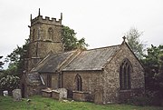
Holy Trinity Church, Blackdown